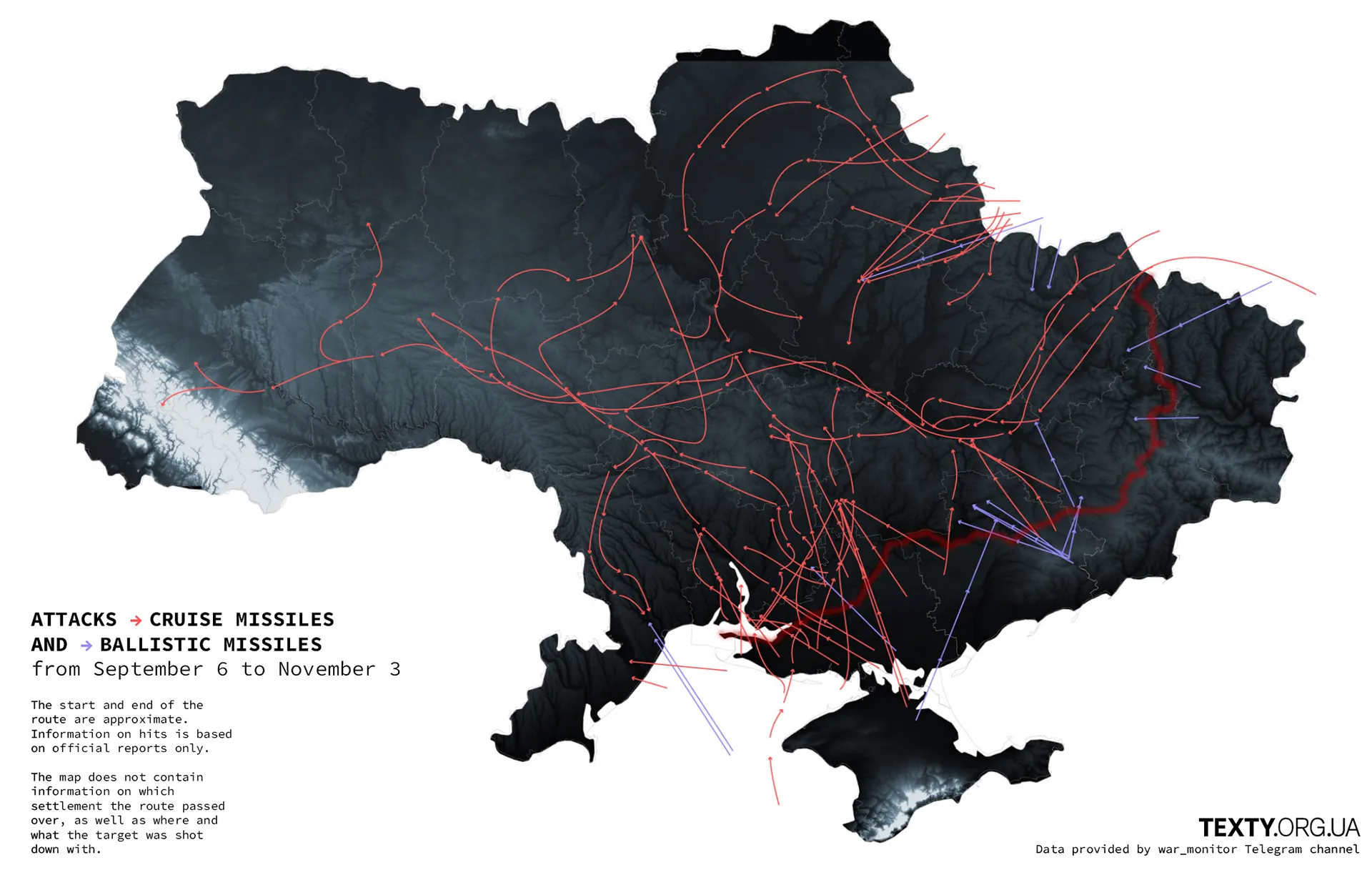
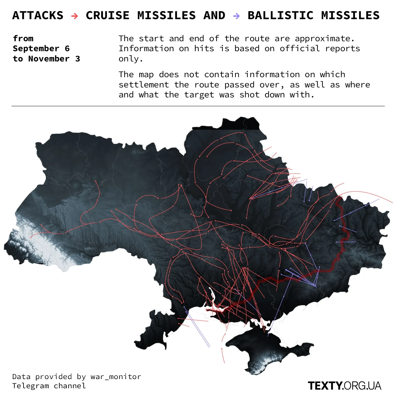
The Air War: The Routes of "Shahed" Drones and Missiles During September-October
We have mapped all the approximate routes of enemy air attacks that lasted from September 6 to November 3. The data was provided to us by the Telegram channel monitor. The routes are approximate, as are their starting and ending points.
Read this article in Ukrainian
Air Force spokesperson Yuriy Ihnat reported that the "Shahed" drones often attack along riverbeds, roads, and regional borders. There is logic to this: flying low over a river can evade anti-aircraft radar detection; the noise of the "Shahed" merges with the sound of cars on roads; and we assume that regional borders may coincide with the junctions of different unit zones of responsibility, which the enemy exploits to slip through.
However, this is not visible on our maps, as the routes are not detailed but approximate.
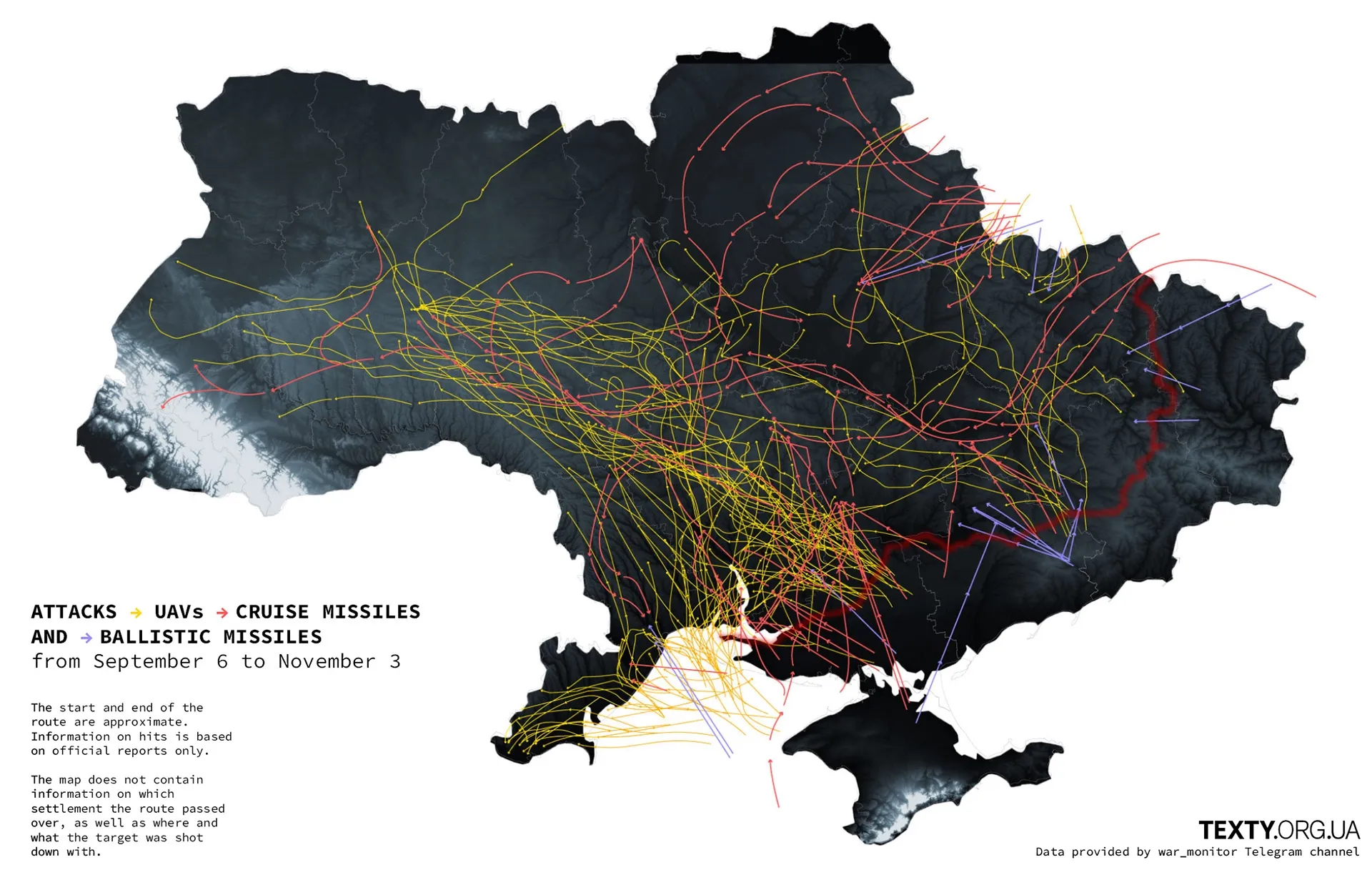
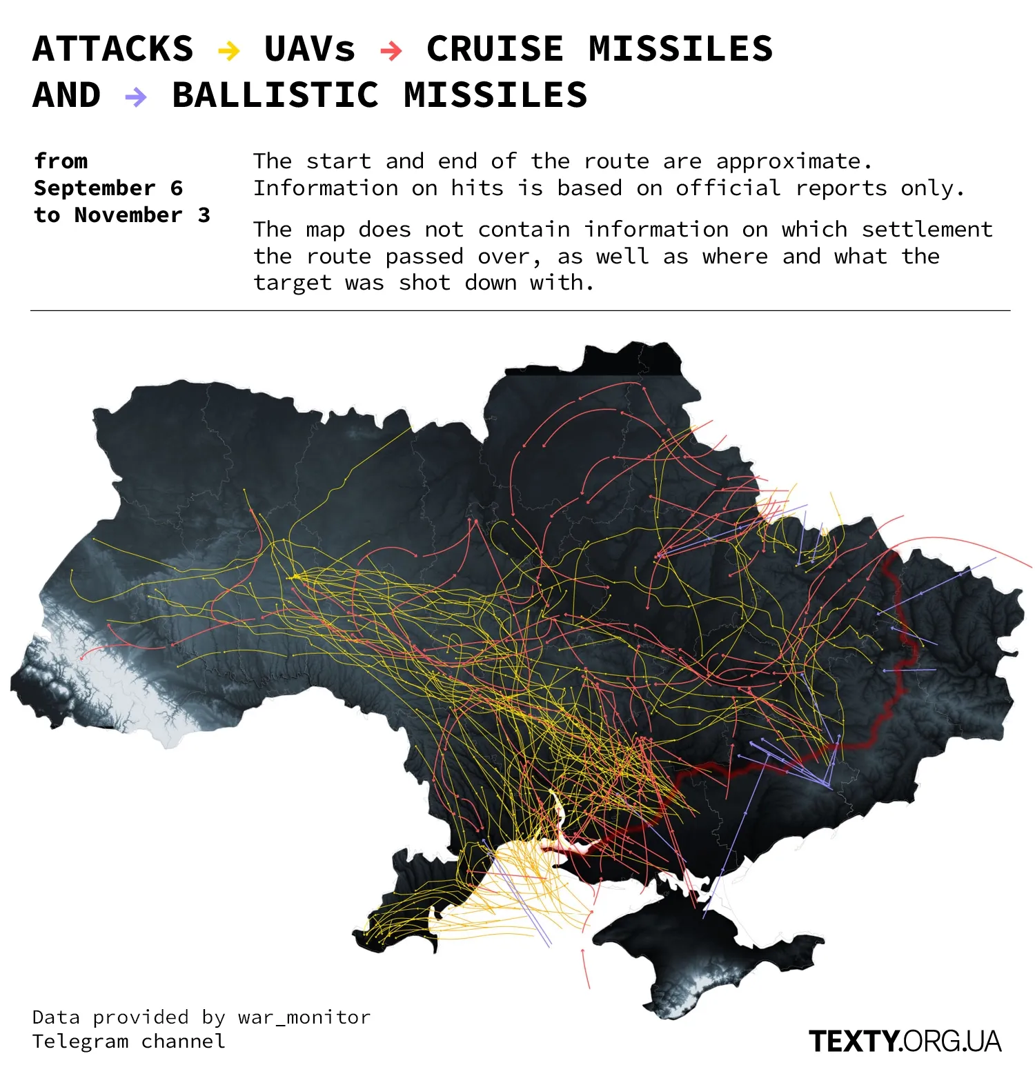
However, the map of "Shahed" attacks reveals one thing: many of them are launched from Crimea. On the map, some routes start in the occupied Kherson region, but we do not know how they fly over Russian-controlled territories. There have been official Ukrainian statements claiming that the enemy launches "Shaheds" from as far as their coast on the Azov Sea, somewhere near the city of Yeysk.
Some launched from Crimea repeat the infamous medieval "Black Path," used by the Tatar horde for raids and subsequently for transporting captured slaves from Ukraine for sale.
Looking at the map leads to one conclusion: Ukraine cannot feel safe as long as it does not control Crimea.
Why the majority of "Shahed" attacks originate from Crimea, rather than Russia, is currently unknown.
However, we can say that liberating Crimea seems more feasible than the de-occupation of Donbas. Once the Ukrainian Armed Forces reach the Azov Sea (a very challenging task as of now) and manage to destroy the Crimean Bridge, the peninsula will fall into our hands like a ripe pear. This is because the Russian troops will be cut off from supplies. The situation in Donbas is different: there, a developed railway infrastructure exists, which Russia can use indefinitely to supply ammunition and reinforcements.
Below are the separate routes of various types of missiles. It's worth noting that "Kalibr" cruise missiles can fly low and maneuver along a pre-set trajectory. Recently, after our naval drones nearly drove the Russian fleet out of Sevastopol, it has become more difficult for the Russians to attack with "Kalibrs." As our officials explained, the equipment for loading missiles onto ships remained in Sevastopol, while the ships were relocated to Novorossiysk. However, sooner or later, Russia will resolve this logistical problem.
Other cruise missiles of the X family are launched from airplanes and fly straight.
Ballistic missiles sharply gain altitude and then fall onto the target, represented on the map as a straight line.
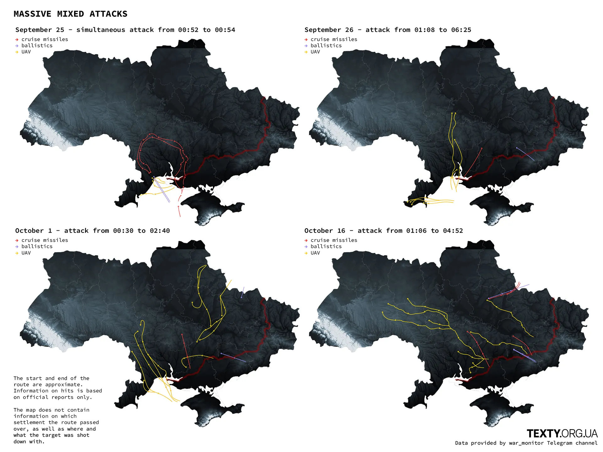
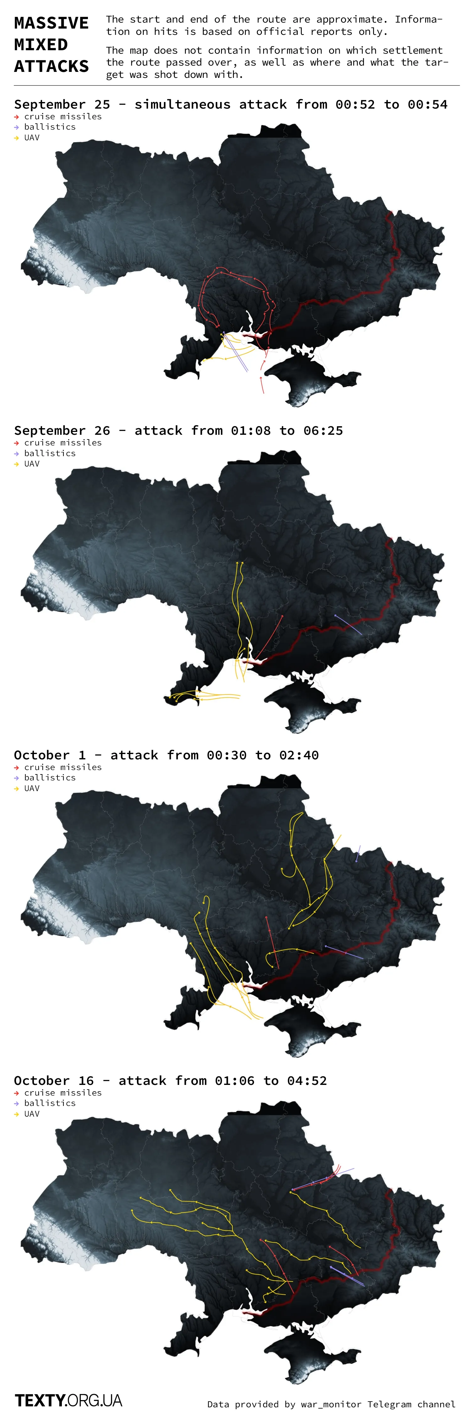
In one of our graphs, we illustrated combined attacks. According to our data, there were two instances where "Shaheds" and various missiles were at the ends of their routes almost simultaneously. And there were two cases where this occurred with a certain interval.
Despite the massiveness and complexity of the attacks, the enemy rarely achieves its target nowadays. Ukrainian air defense is multi-component and well-thought-out. According to Ihnat, a significant portion is intercepted by mobile brigades, which take positions in jeeps equipped with machine guns and spotlights. Additionally, the German "Gepard" has proven to be effective in the war against drones.
Updated December 2, 2023.
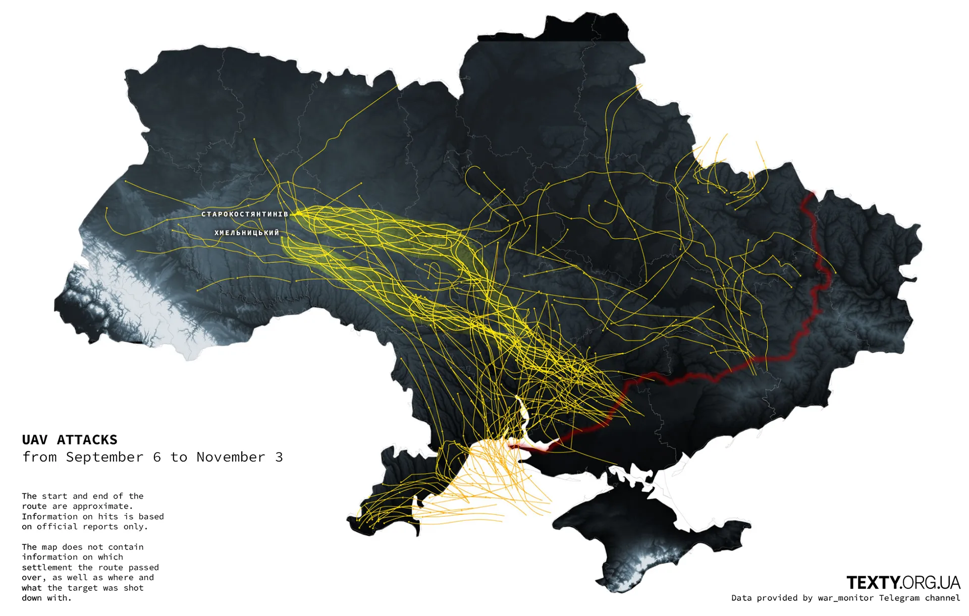
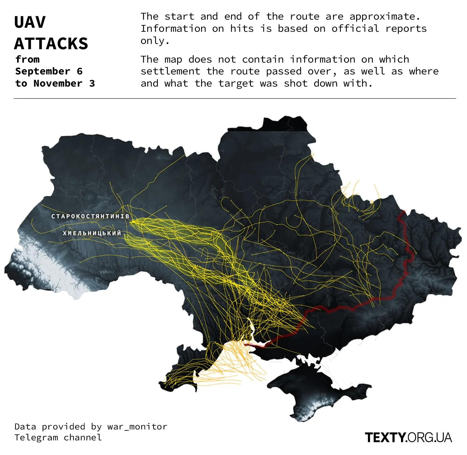
After an extensive meditation on the maps, we've identified two primary drone flight paths and have highlighted them on the map. They target Starokostiantyniv, where our military airfield is located, and Khmelnytskyi. The lower path runs near the E50 highway, while the upper one is along the border of the regions.